Archives: Services

Mining Surveys

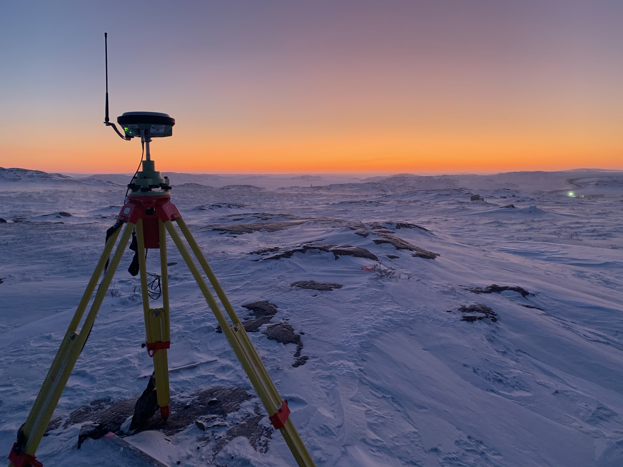
For over a decade, True North Surveys team has specialized in the mining survey sector in the Canadian arctic and sub-Arctic region. We offer surveying services throughout the project lifecycle including exploration, construction, production, operation, and reclamation.

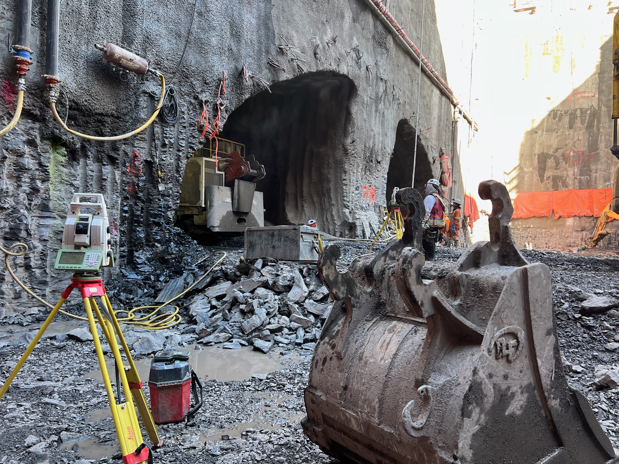
We excel in providing survey solutions for both underground and surface mining operations. We understand the importance of timely results in the mining industry. Our streamlined processes and workflows minimize downtime and maximize productivity.

Our team of skilled surveyors combines technical expertise with a deep understanding of mining dynamics. Whether you are embarking on a greenfield project or seeking to enhance productivity in existing operations, we tailor our surveying services to meet your specific needs.

TNS offers a variety of geomatics solutions for mines including:

  • Open Pit and Underground mining surveys
  • Surface and underground high precision control surveys
  • Blast pattern layout and design
  • Aerial mapping and orthophoto of site
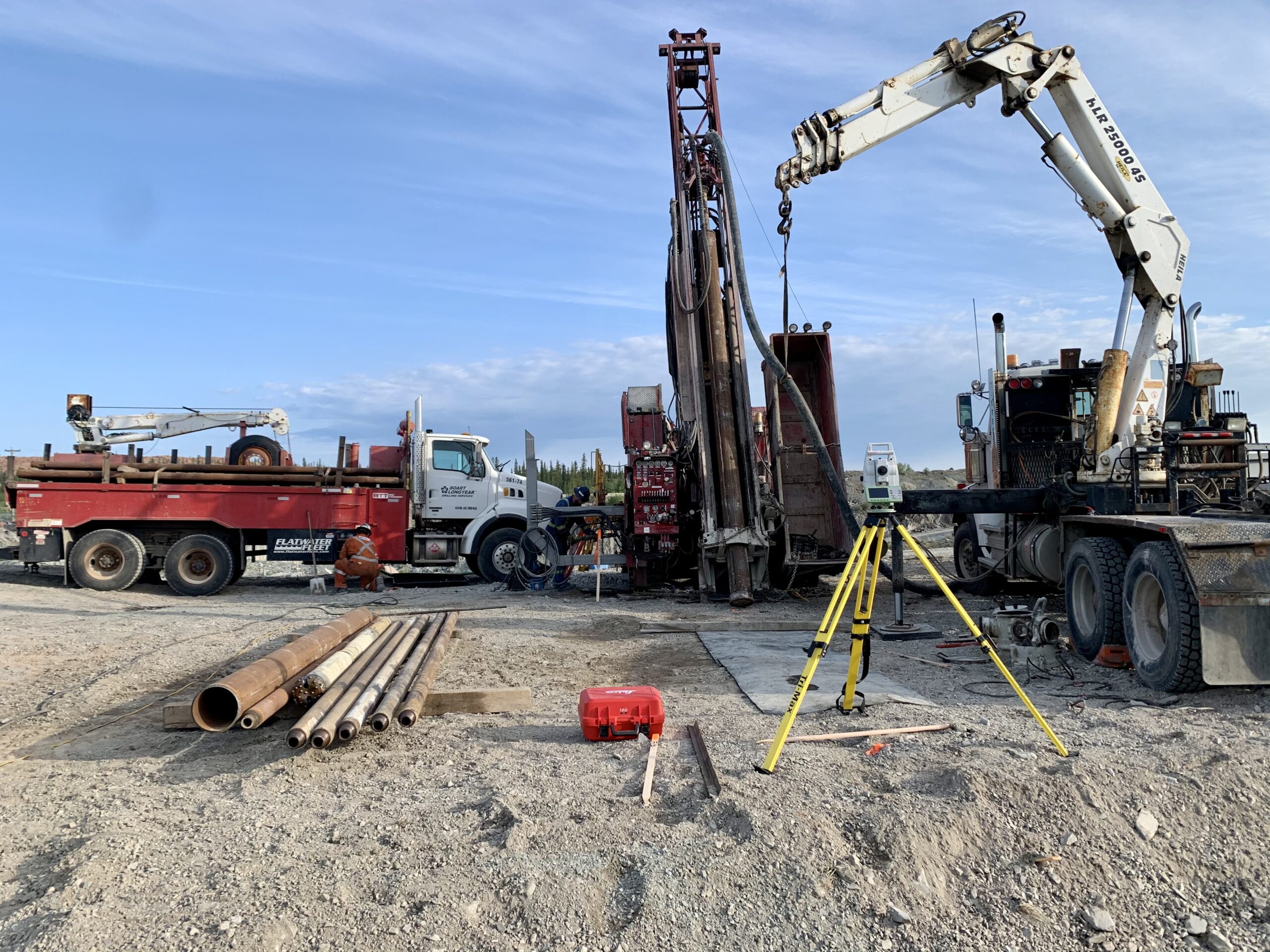
  • Drill collar surveys
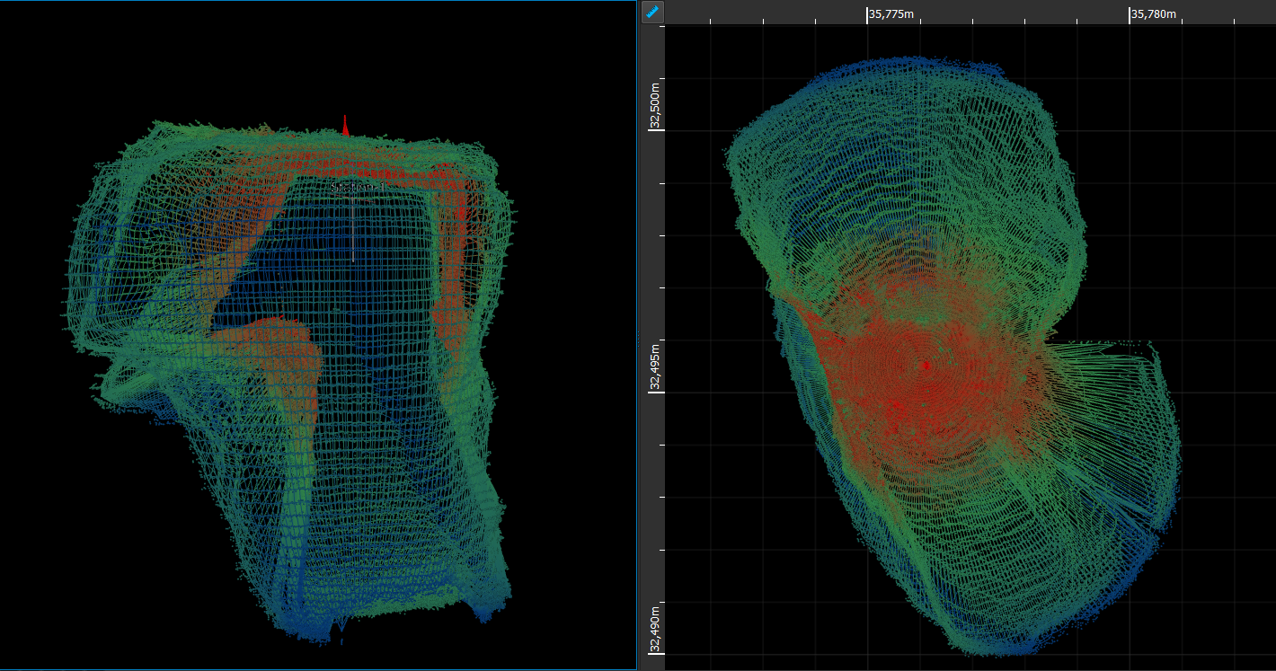
  • 3D Scanning 
  • Pre engineering surveys
  • Construction surveys
  • Mill and conveyor layout
  • Dam deformations surveys
  • UAV drone survey for tailings
  • Bathymetric surveys
  • Earthworks volumes for quantity payments
  • Road reconnaissance surveys
  • Regional geochemical sediment surveys
  • Quality control surveys
  • Powerline and substation layout


Our mining survey specialization extends to drilling survey services which includes : precise drill alignment, downhole surveys, directional drilling and cavity monitoring scanning.


Downhole Surveys

During the drilling process, continuous monitoring is crucial to ensure that the drill remains aligned with the intended path. Downhole surveys rely on the use of precision equipment and technologies. Using top of the line gyroscopes and formulas, True North Surveys is a master in the industry of downhole surveys in Canada.

In some cases, the drilling operation may encounter deviations due to unexpected geological conditions or other factors. Downhole surveys help the drilling team to understand deviation of the steel path.

Construction Surveys

True North Surveys specializes in construction surveying: layout, as built, and data calculation services for construction sites across Canada.

Construction stakeout, also known as a site layout survey, is the process of interpreting construction plans and marking the location and elevations of proposed for new structures such as roads or buildings. Construction staking is performed to ensure that the project is built according to the engineering design plans. The staked reference points guide the construction for proposed improvements on the property ensuring that the construction project is completed on schedule, on budget, and as intended.

  • Civil infrastructure surveys
  • Earthworks and quantity surveys
  • Machine automation services
  • Underground line locating
  • 3D laser scanning
  • Quality control QA/QC
  • Benchmark elevations
  • High precision control surveys
  • Monitoring and deformation surveys
  • As built surveys

True North Surveys has over a decade of expertise in completing construction stakeout by using Leica’s latest and most advanced survey equipment along with specialized software (such as AutoCAD Civil3D and Carlson Civil) to calculate and layout alignments, volumes, road corridors, longitudinal and cross sectioning, surfaces (earthworks, excavation or other), civil works (bridges, tunnels, etc.), concrete buildings, oil and gas industry, railways, municipal service networks and much more.

Topographical Surveys

True North Surveys can provide a full range of topography and mapping services for various stages of land development, construction and infrastructure projects.

A topographical survey is a detailed mapping of the terrain, capturing the elevation, contours, structures, water bodies, vegetations and other relevant features of a site. We at True North Surveys use a combination of high precision Leica GPS, Total Stations, Laser Scanning and UAV to undertake topographic surveys. All our instruments have the facility of remote surveying for the safety of our employees. Offering precise data is crucial for project planning, design, and execution. These surveys produce accurate and comprehensive representations of the land. Survey information is processed through dedicated 3D mapping software to produce the required outputs.

  • Contractors
  • Governments
  • Municipals
  • Mines
  • Land Owners

Directional Drilling

Directional Drilling, also known as directional boring or horizontal directional drilling (HDD), is a specialized drilling technique used in various industries, including construction, oil and gas, and mining. Unlike traditional vertical drilling, directional drilling allows for the deviation of the drill bit’s path, enabling horizontal or angled drilling.

It includes the ability to make real-time adjustments to correct these deviations and keep the drill on the intended course.

True North Surveys has gained extensive experience in precise directional drilling in Arctic and sub-Arctic regions.

Precise Drill Alignment

True North Surveys has lined up over 500 drill holes that reached their target.

Drill alignment in drilling operations refers to the process of ensuring that the drill is accurately positioned and oriented according to the desired trajectory. It is a critical aspect of drilling, especially in applications such as directional drilling or when precision is essential.

Before drilling begins, the engineers and geologist define a target path that the drill steels need to follow. This path is determined based on project requirements, geological considerations, and the desired location for reaching resources or completing a specific task.

Using conventional survey equipment like GPS and Total Station True North Surveys has lined up over 500 diamond and R.C drill holes that reached their target with low deviation tolerance. This include adjusting the dip angle and azimuth direction of the drill to navigate through specific geological layers or to reach a target zone accurately.

CMS

A Cavity Monitoring System (CMS) is a specialized technology used for the monitoring and assessment of underground spaces or voids. It is commonly employed in various industries, including mining, civil engineering, and geotechnical applications. The primary purpose of a CMS is to provide valuable data about the size, shape, stability, and condition of underground voids or cavities. Here are key components and features associated with a Cavity Monitoring System:

Sensors and Imaging Technology

CMS typically integrates advanced sensors and imaging technologies, such as LiDAR (Light Detection and Ranging), laser scanners, or 3D imaging cameras. These tools allow for accurate and detailed mapping of the cavity's geometry.

Remote Operation

CMS systems are designed to operate remotely, allowing for safe and efficient data collection in hazardous or inaccessible underground environments. Remote operation minimizes the need for personnel to enter potentially risky areas.

Real-time Data Acquisition

CMS provides real-time data acquisition capabilities, enabling operators to monitor changes in the cavity immediately. This is crucial for assessing the stability of underground structures, detecting potential hazards, and making informed decisions during ongoing operations.

Surveying and Mapping

The system is equipped to conduct comprehensive surveys and mapping of underground voids. This information is valuable for understanding the spatial characteristics of the cavity, including dimensions, volume, and any irregularities that may impact stability.

Monitoring Structural Changes

Continuous monitoring through a CMS allows for the detection of structural changes in the cavity over time. This is essential for identifying potential risks, such as ground subsidence or movement, and implementing preventive measures.

In summary, a Cavity Monitoring System plays a crucial role in gathering real-time, accurate, and detailed information about underground voids or cavities. Its applications span various industries, contributing to both safety and efficiency in underground operations.

True North Surveys has extensive experience in CMS to ensure the safety of the workers and the project itself.
 
en_CAEnglish (Canada)